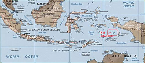
De Kei Islands
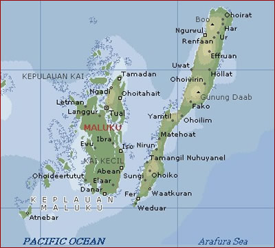
The Kei-islands (also known as the Kai-islands) are a group of islands in the south-eastern part of the Indonesian group of island, the Moluccas (Moluccas province) and have a total surface of 1438 square kilometres. The most prominent islands of the group are Kai Besar and Kai Kecil. The highest point is the mountain of Gunun Daab on Kai Besar, which is 900 metres high.
Kai Kecil (Small or Low Kei, in the local language Ewavs called: Nuhu Roa)
The smaller islands around this island originated through the formation of coral. Compared to Kei Besar, this island is very level, with exeption of the surroundings of the villages Namar (Kelmanut mountains) and Masbait (Gelganit mountains), which are on noticably higher ground. In earlier days, Kei Kecil was divided in three areas: Dullah, Tal and Danar. On this island, the capital of the Kei islands, Tual, is found. The village of Langgur is seen as a second important ‘city’.
Kai Besar (Large Kei, in the locale laguange Ewavs called: Nuhu Yut) basically consists of four goups:
| 1. | Kei Besar (Large Kei, also know as High Kei) |
| 2. | Kei Kecil (Small Kei, also known as Low Kei) |
| 3. | The Tayanda group |
| 4. | The Kur group |
On the northern and southern parts of Kei Besar, there is a large strip of coral formation, completely the samen as the one on Kei Kecil. This island consists of heavy mountain ground and forms one chain of mountains. The most prominent mountain tops are at a hight of 900 metres. According to ancient sources, Kei Besar consisted of seven districts: Waaijer, Elat, Nirun, Fer, Jamtil, Eil and Watlaar.